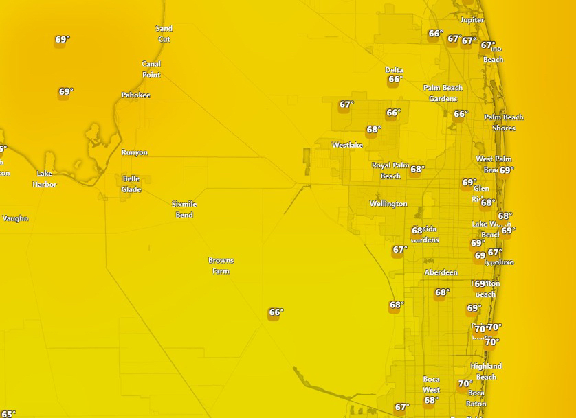
SUNSHINE STATE FORECAST+FollowPalm Beach County, Florida: Showing The Current Reported Temps 1st photo. 2nd Photo for This Afternoon Today with breezy conditions. Cloudy with a chance of more Showers This Early Morning and Towards the Late Afternoon. #flwx #spc #PalmBeachCounty 00Share
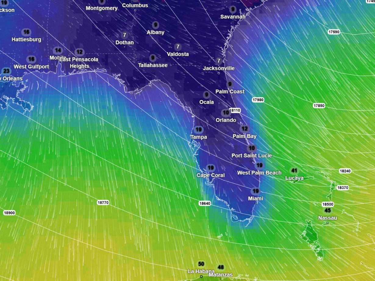
National Weather Forecast+FollowFeel's Like Temps: Signals are strong for a deep trough developing over the eastern U.S., with strong high pressure building in behind it. This setup will drive the coldest air of the season south into Florida. Gusty northerly winds will add significant Wind Chill, making it feel colder than the actual temperatures. Freezing conditions are possible by the end of the weekend for all of Florida, except for southern keys, so preparations should be noted as we get closer. When it comes to Snow only one model is showing slight dusting but if we can get a lingering precipitation oh man this would be it. #flwx #florida #spc #uswx00Share
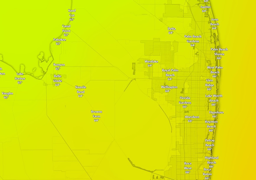
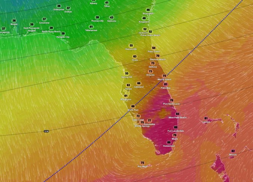
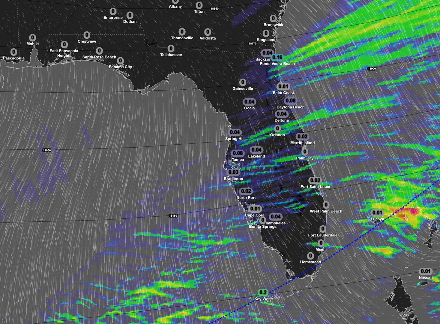
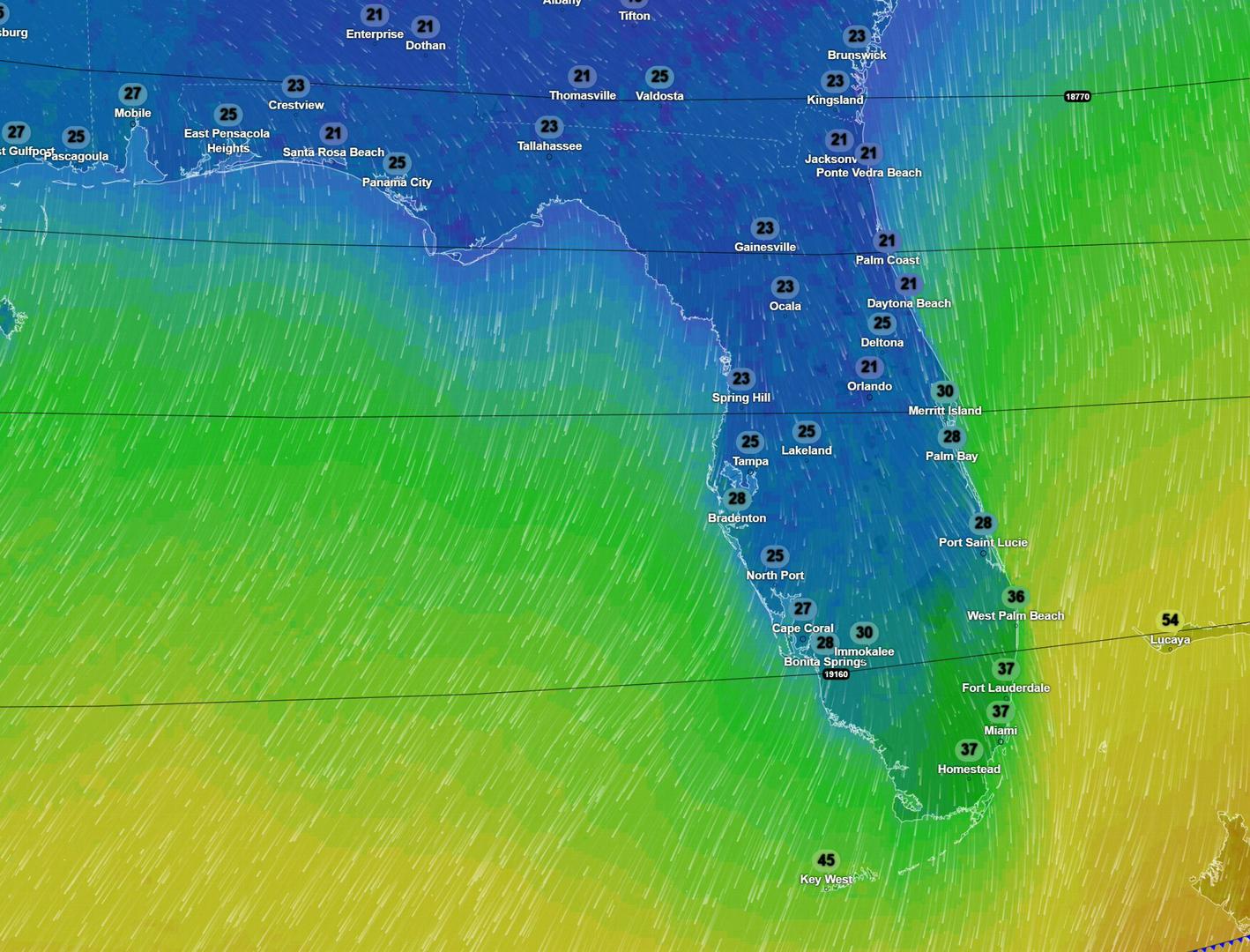
National Weather Forecast+FollowAfternoon Temps will be warmer in front of that Cold front and behind it starts to cool down. There will be some gusty winds as it moves through the peninsula. 2nd photo Rain accumulation as the front moves through not much expected. 3rd photo Feels Like Temps for Tuesday Morning. #spc #flwx #florida #uswx00Share
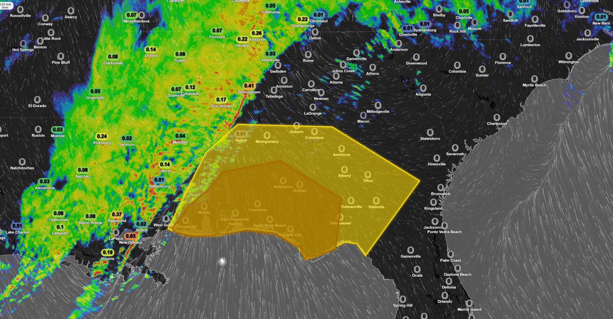
National Weather Forecast+Follow Strong to severe storms are possible as a line of showers and thunderstorms moves through Alabama, the Florida Panhandle, and Georgia. There’s decent dynamic support across the region for strong wind gusts, moderate to heavy downpours, and even a risk of tornadoes, with higher chances closer to the Gulf. While the setup isn’t perfect, 1–2 tornadoes can’t be ruled out. Low-level shear and some instability are present, though limited. A narrow corridor could see quick spin-ups this afternoon, with QLCS embedded tornadoes or an isolated one ahead of the main line. Stay weather aware. ##spc #alwx #gawx #flwx #uswx00Share